
2nd IWA Regional Symposium, PPFW 2017, Izmir, Turkey, 22-24 th March
************Ponencia Symposio IWA 2017 Pantano RELLEU.-TURQUÍA-
El pasado día 22 de Marzo, Dia Mundial del Agua, se presento la ponencia
Assessment of the present state and perspectives of the old dam of Relleu (Marina Baixa, Alacant, Spain)
 en el 2º IWA regional Symposium PPFW 2017 en Izmir (Esmirna) Turkia
La ponencia fue admitida para presentación oral, la que realice relevando a los otros dos autores Pep Climent Brotons (l'Aljup), muy ocupado con su doctorando de la UA) y Miquel Salgor Profesor en la UB en misión en África en las fechas de realización del Simposio. A ambos les agraecemos la participacion en la tarea de rescatar la joya del río Amadorio que es la antigua presa de Relleu así como su integracion al equipo académico que trabaja en el tema y ambos también participantes en las anteriores ponencias a congresos internacionales.
Adjunto encontrareis el texto de la ponencia.
Pablo Gimenez tenia otra esplendida ponencia en preparación para el mismo Simposio pero problemas de diversa índole no permitieron que la versión en ingles llegara a tiempo para ser admitida. De todos modos ya la tiene preparada y se presentara en otra ocasión. Gracias Pablo pues el viejo pantano de Relleu es uno de tus dominios académicos.
Otro tanto sucede con Adres y Joaquin Melgarejo del IUACA de la UA que estaban atrapados en cuestiones académicas y tienen otra ponencia en preparación pero no pudieron acabrla.
Con esta ya tenemos tres ponencias sobre el patrimonio hidráulico del río Amadorio presentadas en foros internacionales
Todas han sido en reuniones convocads por la IWA Intenational Water Associastion sobre temas de patrimonio hidráulico.
La primera fue en Patras (Grecia) con un contenido muy centrado en los molinos hidráulicos
La misma con ciertas molificaciones fue publicada en una revista especializada de la IWA
La segunda, presentada en Coimbra (Portugal), trataba de una balsa de laminacion de avenidas en en Relleu en un afluente del Amadorio.
La tercera es la que os presentamos ahora.
 |
| www.iwa-ppfw2017.org |
Seguimos cada uno y cada entidad trabajando en el tema del rescate del patrimonio hidráulico y en especial del pantano de Relleu y su valorización calificándolo de BIC.
Gracias a todos por vuestra cooperación
Cordialmente
Manolo Soler
- NOTA: INFORME EN INGLÈS **********************************************
Theme D Ancient Water
System, Oral presentation
J. F. Climent*, M. A. Soler**, M. Salgot***
* Geography Department,
University of Alicante, Sant Vicent del Raspeig, Alicante, Spain
** Casa del Escrivà, Plaza
Magistrado Soler 2, 03578, Relleu, Alicante, Spain
***Soil Science Unit and Water
Research Institute (IdRA), University of Barcelona, Joan XXIII s/n, 08028,
Barcelona, Spain
ABSTRACT
The old arch dam of
Relleu (Alacant, Spain) was during three centuries the slendest in Europe, with
a height of 32 meters. Its walls upstream and downstream and its drain tower
were built with ashlar and the nucleus was made from masonry. At the beginning
of the 20th century, the dam was decommissioned and nowadays is
quite entirely silted up and is being degraded. This infrastructure used to
regulate the scarce flows of the Amadorio river and managed the floods of a
Mediterranean regime catchment. At present, there is an increasing interest to
declare the dam site of cultural interest and stop its degradation.
For this purpose,
research has been performed on the history of the infrastructure, the hydrology
and the capacity to manage floods of the basin. The geology and the geometry of
the dam, the auxiliary dam which derives water from another basin, the water leakages,
the needs of maintaining and repair the structure and where exactly are the
fallen off ashlars were also being determined. Apart, the situation of the
quarry which stones were used to build the dam has also been determined. It is also
to value the landscape where the dam is located, including the spectacular
gorge downstream the dam.
The reasons for this
research are the desire of ensuring the survival of the dam and if possible
recover part of its functionality. Finally, to preserve the hydraulic and
constructive heritage values of the dam and its surrounding are necessary.
Main characteristics and history of
the old dam of Relleu
The Relleu dam, a historic jewel of the hydraulic heritage of the
Amadorio River, used to be the slendest dam of Europe during 300 years. This
dam consists of an arched wall between the drain tower and the left abutment of
the structure and is practically flat between the tower and the right abutment.
The 60 m bend radius is constant along the wall. The wall thickness is 10 m up
to the original 28 m height of the original construction, built to supply water
to Villajoyosa town in the Mediterranean seaside. The heightening over the
original fabric is a wall with thickness of 5 m up to the old dam crest, which
is at 31.85 m high (Giménez 2003, Gómez 1958, Fernández 1984) while the measurement of the
authors indicated 31.80 m. The heightening was needed because the loss of
volume through the years due to silting. The location of the dam is perfect
from the constructive point of view (Fig. 1).
 The vertical wall is covered upstream
and downstream of the dam by an ashlar sheet. The material used is sandy
limestone, from the Cenozoic, lower and medium Miocene from a neighbouring
quarry series (Fig. 2). The nucleus is made from masonry. The drain tower is
built using ashlar stones, 0.4 x 0.2 x 0.3 m.
The vertical wall is covered upstream
and downstream of the dam by an ashlar sheet. The material used is sandy
limestone, from the Cenozoic, lower and medium Miocene from a neighbouring
quarry series (Fig. 2). The nucleus is made from masonry. The drain tower is
built using ashlar stones, 0.4 x 0.2 x 0.3 m.

Fig. 1. Geometry of the dam. A)
Schematic view from downstream with the window of the scour outlet. B)
Schematic view from upstream, showing details of the silting up (the changes of
width of the wall are not shown). The reference axis appears in both figures.
The dam receives its water from the Amadorio basin
upwards from its location. The surface of the draining basin is 10,453.2 ha and
goes from the upper part, in the highest peak of the basin (1,217 m Rentonar range) to the bottom of the dam (275
masl).
The Relleu’s dam has an auxiliary dam (Fig. 3) which
receives water from the Fasamai and Cortés basins and diverts it to the
Relleu’s dam, recovering the water that should have been reaching the Amadorio
below the dam. The auxiliary dam drives the water through a bypass channel
(Fig. 4) partially carved into the rock. By this way, the draining basin surface
is increased by 324.7 ha. This secondary basin has its maximum height at 565 m
and its minimum at 285 m. Between the main and the auxiliary dam there is the
guard house (Fig. 5) accessible by ladders built or excavated in the ground.
Fig.
2 El Brull quarry Fig.3 Auxiliary dam Fig. 4 Diversion canal Fig.5
Guard’s house

Fig.6.
Views of the dam. A) The Wall seen from downstream and
the tower B) Section of the dam
The drain tower is 5.37 m high over the sediments, 2.20
to 2.63 m width and 31.85 m high. At present, the sediments are covering the
tower quite entirely, and only the upper part of the tower can be seen (Figs. 2
and 6).


The climatic characteristics of the catchment are the
typical of the southeast of the Iberian Peninsula. Temperatures are mild all
the year round and equinox rains more usual during October, with irregular
heavy rains in wintertime and quite no rain during summer because of the
tropical subsidence related to Hadley cells. This subsidence is generating the
persistent summer droughts in the area. The catchment is heavily dissymmetric
in terms of climate, influenced by two key geographical factors, relief and
orientation. Then, the average rainfall of the area is not homogeneous and several
points of the catchment, located inland by the Amadorio’s source, receive a maximum
rain, 800 mm/year, while in the meridional part of the basin the isohyet is
around 350 mm/year. The temperatures are also dissymmetric, because of the same
geographical factors which affect the rain. In the inland part of the catchment,
frosts in winter time and there are mild temperatures in summertime, usually with
cool nights. In the south of the catchment, frosts are really scarce and short and
this area is warmer in summertime (Fig. 7).
The hydrological
characteristics of the Amadorio river correspond to a river-ravine system,
typical from the Spanish southeast, having irregular flows combined with
equinox maximums (following the rain episodes) associated with sudden high
flows in wintertime and a general minimal flow during summertime, when usually
the river becomes dry. Nevertheless, there are other specific factors which
make the area unique; after cool and humid winters, the Amadorio river regime
can be nival, as well as the one of its main effluent, the Sella.
The catchment has an area of
10,543 ha, mainly in the municipality of Relleu. The southern part has a
rounded shape, while in the north is rectangular (Fig. 7). The river flows,
from the source to the dam, along 16,142 m and from the west to the east.
Arriving at the old Rabós mill the
Amadorio becomes encased until reaching the Palanquetes
area, where water starts to be used for irrigation and in the past was also

used to generate energy in several
mills. The flows were derived using weirs until the river reached the dam. A
really impressive set of storage and distribution canals was implemented and is
still used for irrigation purposes.
The Climate Change
previsions for the area describe the possibility to modify the pattern of
rainfall, increasing the irregularity of rains and as a result the hydrology of
the river. If predictions become reality, the drought episodes will increase
being longer, and the flash floods more raging. In the last 20 years, an
increase of 0.5 ºC (Fig. 8) in the Alcoleja weather station, near Relleu, has
been observed (Soler, 2010) confirming the possible
tendencies.
Figure 8 Temperatures in the Alcoleja (Alacant
province, Spain) weather station


The dam
revisited, its present state and restoration needs
The authors have been visiting the dam several times
between 2014 and 2016 in order to reconfirm measurements, revise the
surrounding area and detect and confirm the degree of deterioration of the
infrastructure and the possibility and origin of water losses inside the ponded
area.
The downstream wall is partially collapsed as a consequence
of overspills, the vegetation (Fig. 9) which is growing over it (partially
removed nowadays), and the lack of maintenance. The vegetation (even trees of
big size) includes a fully grown taray (Tamarix
gallica). Is in this part of the wall where more ashlars have been
collapsing, leaving the masonry of the dam nucleus exposed (Fig. 6).
Fig.
9 Vegetation in the walls and crest of the dam

Abundant vegetation is growing on the crest, which is helping
to keep the spillway by the left margin of the dam, as it seems was intended
when the dam was designed and is shown in old pictures (Soler, 1910) (Fig. 10). At present (2017), the water is spilling
along the crest (Fig. 11) when there is a certain amount of water. At the same
time this vegetation is deteriorating the structure. The old picture (Fig. 10) is
showing that the crest was entirely covered by ashlars and used to have a tier
nowadays disappeared and located downstream, not upstream (Fig. 6 B).
Fig. 10 The dam overflow, 1900 Fig. 11 The dam overflow, 2017
 The drain tower is apparently well
preserved but partially silted and without the wooden cofferdams which allowed
to choose the level of water extraction.
The drain tower is apparently well
preserved but partially silted and without the wooden cofferdams which allowed
to choose the level of water extraction.

The auxiliary dam (Fig. 3) is just a
stone wall, recovered with lime mortar with a maximum width in the crest of 0.5
m which at present is completely silted, but does not matter because it is
acting as a derivation canal for the waters arriving from the Fasamai and
Cortés catchments towards the Relleu dam. This canal (Fig. 4) is carved in the
rock and has a changing depth with a width of 1 m until it reaches a small
canyon, probably generated by the water after years of spillage, and as
indicated before is draining to the Amadorio upstream the main dam.
The quarry, which supplied the
ashlars used to recover the masonry works, is located in a neighbouring area at
about 2,000 m from the dam, and is called “El Brull” (Fig. 2). The ashlars were
transported downwards which made the process easier. The comparison of the
materials from the dam and the quarry, as well as the oral tradition, confirm
this statement. If the dam is to be rehabilitated, to know the place of the
original material is important for several reasons, such as economy, facility
of building, and homogeneity of materials, existing and new ones.
An examination of the foot of the
dam was also performed following the riverbed downstream the facility, through
the gorge of the Amadorio (Fig. 12). The gorge is following a fault which cuts
the Orxeta range and is showing very weathered walls; smoothed by the passage
of water though centuries. In the bed there are alternatively dry passages and
pools requiring the passers-by being wetted to follow the path. The gorge
scarcely receives sun in the bottom, only a few hours in summertime. The
examination was performed from the base of the dam to an area downstream where
the walls collapsed, thus creating a wide area where the vegetation,
spontaneous and invasive, is growing without being disturbed due to the
difficulty of reaching this site. Along the gorge, several ashlars can be found
both in dry or inundated areas, all of them eroded because of having rolled away
and due to the action of flowing water. The gorge has several meanders and
because of this, and the other mentioned circumstances, it would be difficult
to recover the fallen ashlars if desired. Additionally the installation of
several zip lines, winches and cable cranes would damage the surrounding
environment and the walls of the gorge; this solution is to be discarded. The
use of aerial systems to recover the ashlars will also be dangerous due to the
scarce width of the gorge. For the mentioned reasons, it was important to
localise the quarry where ashlars from the same material than the original ones
could be obtained. It is estimated that around 1,200 ashlar pieces would be
necessary to fully restore the walls downstream the dam and the crest and for the
reconstruction of the old tier. Just at the bottom of the dam, the width allows
the implementation of a scaffold system to rebuild the walls downstream. The
transportation of the ashlars from the identified quarry to the dam can be
performed by using trucks.
The restoration of the drain tower
is not difficult indoors. For the moment this restoration is not necessary
outdoors because the dam is quite fully silted. If it is desired to place
cofferdams for controlling the drainage, it would be difficult to uncover the
whole tower because it would mean some accommodation of the silting material
near the dam wall which could affect the structure. Even if all the elements of
the tower drainage systems were rebuilt, it could not be enough for using the
dam as a regulating manageable infrastructure, considering that several water
leakages were detected in 2015 in the walls of the reservoir but not in the
walls of the dam.
Fig. 12 The gorge after the dam


Present state of the reservoir and the possibility of
exploitation
The silting of the reservoir created a flat area
located approximately at a height of 275 masl. This plain is absolutely filled
with vegetation mainly in springtime with a huge amount of autochthonous plants
such as the thistle (Fig. 13) or invasive, like the American reed (Arundo donax), flourishing at springtime
(Marcos,
2003). Last years another
invasive species appeared, like the saltmarsh aster (Aster squamatus). In the area several small mammals (rabbit mainly
– Oryctolagus cuniculus), birds
(goldfinches – Carduelis carduelis,
turtle doves – Streptopelia turtur,
and wood pigeons - Columba palumbus)
and its predators (foxes - Vulpes vulpes,
and eagles like Aquila crysaetos) are
described. When pools are formed, are quickly colonized by anatidae species.
Geologically, the
dam is located over a calcareous lithology, mainly formed by nummulites,
dolomites, dolomitic breccias and marls; materials highly permeable. All of
them are from the Mesozoic era, Cretaceous system of the upper series and
Senonensic basin; like the Orxeta range, which includes green clays of medium
permeability, from the same Mesozoic era and cenomanian-turonian stage, more
than 100 million years old. The surrounding areas are not so old in geological
terms, like Quaternary sediments. Additionally, the dam is located in a
concordant contact near an inverse fault located north of the dam.
The leakage of water happens
in the lateral areas of the dam, not in
the wall. There the terrain presented cracks which were sealed in the past
(Fig. 14) using cement mortar. The water leakage through the cracks
(microfaults) is present especially in the Amadorio riverbed, but not in the
bed of the Salat ravine, also named Cova ravine. 25 sinks where water
infiltrates have been located in the surface of the sediments (field works of
the authors, 2015); the sinks shift due to local changes of leaking capacity in
the sediment’s cracks, which become sealed and thus water finds new ways down.
Those leaking places are nearly aligned with the underlying faults, parallel to
the Orxeta range. From this, can be deduced that the bottom and walls of the
dam vessel are not impervious and the amount of water lost in this way can be
important. This is an added difficulty to recover the original goals of the
dam. It would be interesting to know the final destination of the water lost by
infiltration which reaches the faults, because the leakage seems to be recharging
certain aquifers of the area. The losses through the nummuliting calcareous
stones have been calculated to be 80 L/s with the dam fully filled (Confederación
Hidrográfica del Xúquer, 2016).
Fig. 13 Flowering thistle Fig. 14 Seals with mortar Fig. 15 Dam, vegetation and gorge

Landscape around
the dam. Appealing places
The dam is
located in a complex geographical location, a wild and rough landscape in the
deepest part of the Relleu municipality, in the ideal place to be built, a
narrow gorge eroded by the flowing water. It is a place where the efforts to
build a dam would be minimal, with the maximum benefit in terms of water
storage. The gorge is the natural outflow of the river-ravine Amadorio. The
gorge or gully (estret, meaning
narrow, in the local expression) has by itself a unique attractiveness. The
gully has vertical walls of more than 200 m high, walls with slopes exceeding
100% in some places. The bottom of the river is located 225 masl, while the
crest of the range is placed at 527 masl. This is a perfect place for extreme
sports, like canyoning and climbing (Fig. 12) and bird watching in a natural
reserve. This attractiveness is favoured by the presence of dolines, poljes,
canyons, gorges… formed along millennia by the action of water.
From Relleu,
looking west in direction to the dam, it is possible to see clearly the
depressed area. This area is formed by a terraced landscape, cultivated for
centuries and holding a lot of relics of the past; like a small aqueduct named
the Arcà or the arcade (Fig. 15), in
the middle of the orchard. A great number of canals and ditches form the
complex hydraulic network of the Reg Major or great irrigation canal; as well
as other weirs which manage the water of the Amadorio (Fig. 15) (Maquiegui, 2013, Soler
2015). All this terraced Mediterranean landscape merits a detailed visit. The
system is immerged in a framework of a xeriscape, with schlerophyll and
perennial vegetation. The Mediterranean maquis shrubland or the garrigue
include esparto grass (Spartium junceum)
and dwarf palm (Chamaerops humilis).
Fig. 15 Part of the hydraulic heritage of the Amatorio
basin


The hydrology of
the Amadorio River and the influence of the dam
The hydrology of the Amadorio basin was performed by
using conventional methods and coefficients that several authors counsel for
this area (runoff coefficient 0.30, a little bit higher than the 0.25 indicated
by Gil (1972), because
persistent rains which overcome the field capacity of the soils and a k
uniformity coefficient of 1.32 are being considered). The work performed has
been tested applying the figures and calculations to a rain episode during
January 2017. The amount of rain was 181 mm at Relleu (www.avamet.org) along 72 h in 4 days. At the 101,76 hours of the
episode; 103,29 m3/sec were registered. During that period the
runoff through the river and the losses in the crest of the dam were measured.
The hydrogram obtained is being shown at the Figure 16. Once verified, the
hydrograms for the return periods of 25, 50 and 100 years were calculated as
indicated in the Fig. 17.

CONCLUSIONES :
The Relleu dam, an architectonical and engineering
jewel of the 17th century needs, at present, immediate but simple
fixing actuations in order to avoid that any eastern gale, such as the one of
last January 2017, could destroy the dam wall due to the erosive activity of
water when overflowing the crest.
A previous action should be the elimination of the
vegetation growing on the dam structure.
The ashlars lost by the action of the floods should be
replaced by using similar pieces and, additionally, the recovery of the drain
tower must be performed to return the dam certain regulation and aquifer
recharge capacity.
The necessary bureaucracy to qualify again the
infrastructure as a Place of Cultural Interest would ensure the future of the
dam (Melgarejo
2015, Soler 2015). It will become, as
well, an ornithological reserve.
Bibliografía
Gil, A., Rico, A. M. (2015), Consorcio de aguas de la Marina Baja: gestión convenida, integral
y sostenible del agua. Instituto interuniversitario de Geografía, Universidad
de Alicante D.L. 2015; ISBN 978-84-697-1947-3; 327pp.
Marco, J. A.; Atles fitonómic d’Alacant. Publicaciones Universidad
de Alicante.
Giménez, P. (2003);
El pantano de Relleu y el riego de la huerta de Villajoyosa (1653-1879),
investigaciones geográficas nº30 (2003) pp 97-118, ISSN: 0213-4619.
Soler, M.A. (2010); ¿Seguirá lloviendo en Relleu? III
Centenial Book, 1710 El milagro de la lluvia. Asociación Cultural Benesit.
Soler Manuel, Manuel and Alt. (2015) Simposium La presa
de Relleu (Sgl. XVII) Referencia del patrimonio hídrico. Associació Benesit.
Melgarejo, J. (2015) Los pantanos de la Epoca Moderna en la
Provincia de Alicante. Editorial Diputacion de Alicante. ISBN 8415327633,
9788415327639
Marquiegui, A. (2013) El patrimonio hidráulico de la
provincia de Alicante. Diputacion de Alicante.
Visores:
Fernández, J.A. (1984) Catalogo de noventa presas y
azudes españoles anteriores a 1900. Ed. Comisión de Estudios Históricos de
Obras Públicas y Urbanismo. Madrid 511 pp.
Gil, A. 1972, Embalses españoles de los siglos XVIII y
XIX para riego. Estudios Geográficos, 129, Universidad Autónoma de Madrid, pp
557-596
Gómez, J. Juan-Aracil, J, 1958, Saltos de agua y presas
de embalse. Escuela de Ingenieros de Caminos Canales y Puertos, Madrid, 2
volúmenes.
**********************************************
20170322-RELLEU-PANTANO_2nd IWA Regional Symposium, PPFW 2017, Izmir, Turkey, 22-24 th March
http://relleupantano.blogspot.com.es/2017/03/20170322-2nd-iwa-regional-symposium.html
**********************************************
20170322-RELLEU-PANTANO_2nd IWA Regional Symposium, PPFW 2017, Izmir, Turkey, 22-24 th March
http://relleupantano.blogspot.com.es/2017/03/20170322-2nd-iwa-regional-symposium.html


Bu e-posta tarafınıza 2n Simposi Regional sobre Aigua, Medi Ambient i Aigües Residuals (IWA-PPFW2017)
tarafından oluşturulan Member veritabanına
alqueriasoler@telefonica.net adresi ile kayıtlı olduğunuz için gönderilmiştir.
Üyelik bilgilerinizi güncellemek ja dóna üyelikten ayrılmak için tıklayın .
2n Simposi Regional sobre Aigua, Medi Ambient i Aigües Residuals (IWA-PPFW2017) gönderimlerinin tarafınıza
sorunsuz ulaşmasını istiyorsanız lütfen
albedoturizm@euromsg.net adresini güvenli kullanıcılar listesine ekleyin.
++++++++++++++++++++++++++++++++++++++++++
- Como os indique adjunto la invitación a participar en el congreso de la IWA en Turquia.
Fijaos que entre los temas convocados los numero 1 y 2 1) Assessing ancient water system,
2) Assessing water history, encajan perfectarament en las cuestiones de patrimonio hidráulico y de exponer y reconocer los méritos
del pantano/presa de Relleu para ser declarado BIC incluyendo el resto de patrimonio del río Amadorio.
Pulsando sobre las direcciones destacadas en azul aparecerá mas información sobre la convocatoria.
Cordialmente
Manolo Soler.
- On behalf of the Organizing Committee, it is a great honor for me to welcome
you to join IWA Regional Symposium on water, wastewater and environment to
be held on 22-24 March 2017 in İzmir, Turkey. (www.iwa-ppfw2017.org)
Climate change and exponential population growth have threatened the world's
supply of water resources from past to present with dire implications for
economy, environment, and human health. Many water issues are high on the
political agenda, whether it concerns the lack of access to safe water and
sanitation or the increase in water-related disasters due to natural disasters.
On behalf of the Organizing Committee, we are very pleased to invite you to
participate in the 2nd IWA Regional Symposium on the past, present, and future
of the world's water resource. The topics of this symposium include but not
limited to:
1) Assessing ancient water system,
2) Assessing water history,(Pantà de Relleu).
3) Tracking and monitoring of water resources,
4) Advancing innovative techniques and novel approaches to simulate and
monitor the effects of local management and climate change on water resource,
5) Assessing the pressures and threats: impacts of global environmental changes
on water resources,
6) Assessing surface and groundwater interaction,
7) Hydrology and Hydrogeology,
8) Wastewater and its treatment,
9) Innovative treatment technologies
We're looking forward to meeting you in the IWA Regional Symposium on water,
wastewater and environment to be held on 22-24 March 2017 in İzmir, Turkey.
The 2nd IWA Regional Symposium will provide special emphasis on the past,
present, and future of the world's water resources.
Prof.Dr. Alper BABA
İzmir Institute of Technology
Engineering Faculty
Email: alperbaba@iyte.edu.tr
Phone: +90 535 4698367
Phone: +90 232 750 6807
Bu e-posta tarafınıza 2nd Regional Symposium on Water, Wastewater and Environment (IWA-PPFW2017)
tarafından oluşturulan üye veritabanına
alqueriasoler@telefonica.net adresi ile kayıtlı olduğunuz için gönderilmiştir.
Üyelik bilgilerinizi güncellemek ya da üyelikten ayrılmak için tıklayın.
2nd Regional Symposium on Water, Wastewater and Environment (IWA-PPFW2017) gönderimlerinin tarafınıza
sorunsuz ulaşmasını istiyorsanız lütfen
albedoturizm@euromsg.net adresini güvenli kullanıcılar listesine ekleyin.
20140428-Relleu-IWA-Simposio Regional del Aguas-22 y 23 de marzo del 2014 en Patras (Grecia).
20170322-Congreso de la IWA en Turquia del 22 al 24 de Marzo de 2017. (Pantà de Relleu-Riu Amadori) =*BIC*. Call for IWA-PPFW2017
20170322-RELLEU-PANTANO_2nd IWA Regional Symposium, PPFW 2017, Izmir, Turkey, 22-24 th March- versión en inglés.
20170317-EVALUACION DEL ESTADO DE LA ANTIGUA PRESA DE RELLEU, PERPECTIVAS FUTURAS - versión en español.
http://relleupantano.blogspot.com.es/2017/04/20170317-evaluacion-del-estado-de-la.html
- INVITACIÓ-INVITACION-*****************************************
- Com us adjunto Indiqui la Invitació a Participar en el Congrés de l'AIT a Turquia.
Que fixeu-vos Entre els Temes convocats els numero 1 i 2 1) Avaluar antic sistema hidràulic,
2) Avaluació de la història de l'aigua, encaixen perfectarament en les Qüestions de patrimoni hidràulic i d'exposar i Reconèixer
els mèrits del pantà / presa de Relleu Per Ser declarat BIC incloent la resta de patrimoni del riu Amadorio.
Fent clic a sobre Sobre les direccions destacades en blau apareixerà més informació sobre la convocatòria
cordialment
Manolo Soler.
- En nom del Comitè Organitzador, és un gran honor per a mi donar la benvinguda
a unir-se Simposi regional IWA sobre l'aigua, aigües residuals i el medi ambient
que tindrà lloc els dies 22-24 de març de 2017 Esmirna, Turquia. ( www.iwappfw2017.org )
El canvi climàtic i el creixement exponencial de la població han amenaçat l'oferta
mundial dels recursos hídrics del passat al present, amb conseqü.ncies nefastes
per a l'economia, el medi ambient i la salut humana. Molts problemes de l'aigua
són una prioritat en l'agenda política, si es refereix a la manca d'accés a aigua
potable i el sanejament o l'augment dels desastres relacionats amb l'nigua a
causa dels desastres naturals.
En nom del Comitè Organitzador, estem molt contents de convidar-lo a participar
en el 2n Simposi regional IWA sobre el passat, present i futur dels recursos
hídrics del món. Els temes d'aquest simposi inclouen però no es limiten a:
1) Avaluar ant
2) Avaluació de la història de l'nigua, (Pantà de Relleu)
3) Seguiment i monitoratge dels recursos hídrics,
4) Promoció de tècniques innovadores i nous enfocaments per simular i controlar
els efectes de l'administració local i el canvi climàtic en els recursos hídrics,
5) L'avaluació de les pressions i amenaces: impactes dels canvis ambientals a
nivell mundial sobre els recursos hídrics,
6) Avaluació de la interacció superficial i subterrània,
7) Hidrologia i Hidrogeologia,
8) Les aigües residuals i el seu tractament,
9) Les tecnologies de tractament innovadores
Estem buscant comptar amb la seva presència en el Simposi regional IWA sobre
l'aigua, aigües residuals i el medi ambient que tindrà lloc els dies 22-24 de març
de 2017 Esmirna, Turquia. El 2n Simposi regional IWA proporcionarà un èmfasi
especial en el passat, present i futur dels recursos hídrics del món.

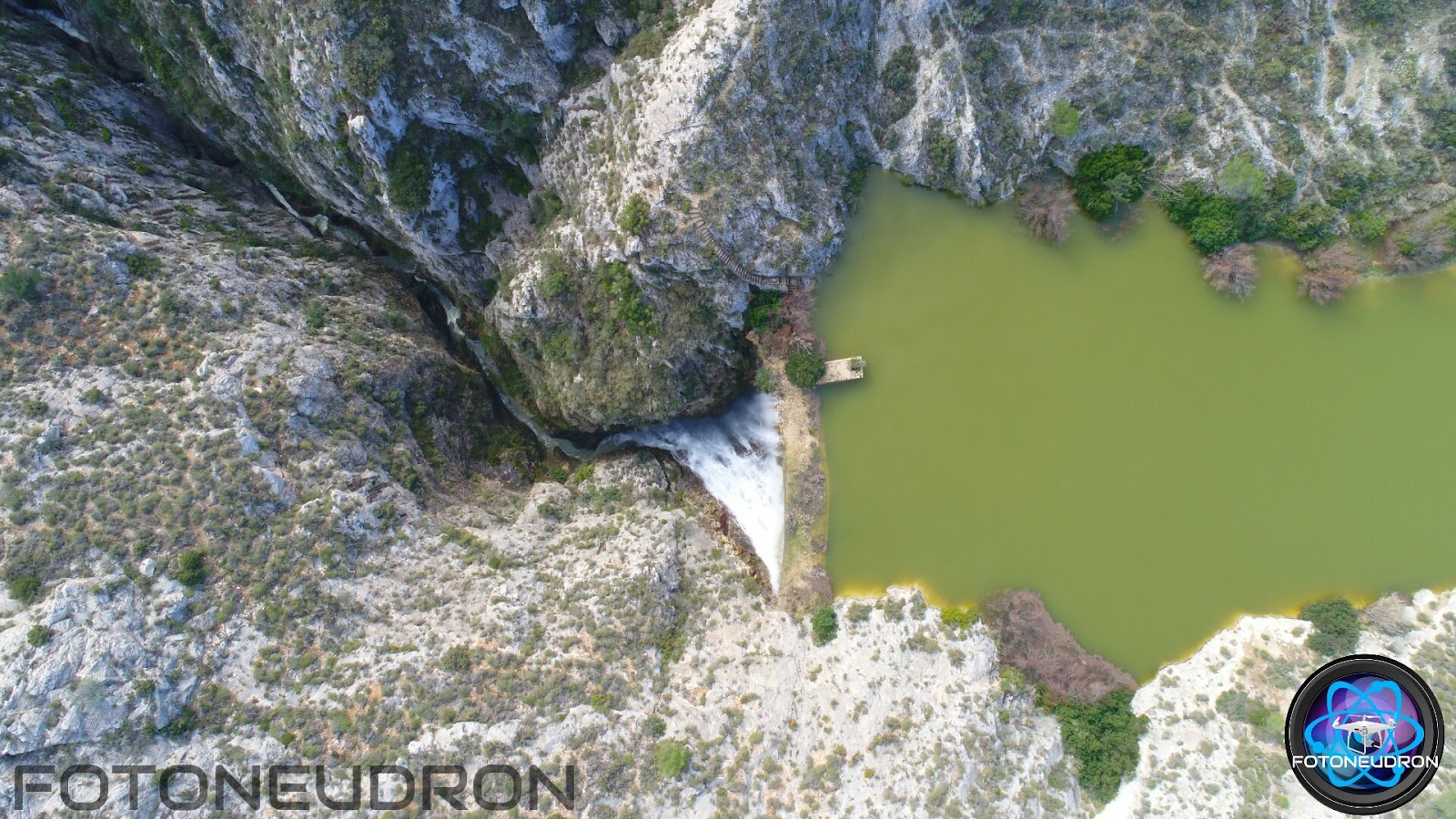
FOTO DE FOTONEUDRON,27.02.2016 http://neutronreefman.wixsite.com/fotoneutron
- 20170131-VIDEO-RELLEU -PANTÀ -EMBALSAMENT DE RELLEU -S.XVI-XVII. xFotoneutrón2017 http://relleupantano.blogspot.com.es/2017/03/20170131-video-relleu-panta-embalsament.html
- 20170202V-Relleu- DE RELLEU A ORXETA POR EL CAMINO MÁS GUAPO x Jaime Escolano -Guia de Montaña. http://relleupantano.blogspot.com.es/2017/03/20170202v-relleu-de-relleu-orxeta-por.html
- 20150619V-Relleu-Pantà/Embalsament de Relleu (S.XVII-XVIII) - Temporada de secá- http://relleupantano.blogspot.com.es/2017/02/20150619v-relleu-pantaembalsament-de.html
- 20150619V-Relleu-Pantà/Embalsament de Relleu (S.XVII-XVIII) - PANTÀ SÉC D'AIGUA- http://relleupantano.blogspot.com.es/2017/02/20150619v-relleu-pantaembalsament-de.html https://youtu.be/sS-5qgQeDY0
- 20110317V-Relleu-Barranco de Relleu x BenidormAventuras_a17/03/2011.
- http://relleupantano.blogspot.com.es/2017/03/20110317v-relleu-barranco-de-relleu-x.html
- 20091009V-Relleu-EL BARRANCO DE RELLEU-(8/10/2009) xMiguelAngel. http://relleupantano.blogspot.com.es/2017/03/20091009v-relleu-el-barranco-de-relleu.html https://youtu.be/HyjxpYrVl-g
20170419-EL PLAN GENERAL DE ORDENACION URBANA DE RELLEU-
Historia del empecinamiento municipal
Historia del empecinamiento municipal
http://relleupantano.blogspot.com.es/2017/04/20170419-el-plan-general-de-ordenacion.html http://iniciativaperrelleu.blogspot.com.es/2017/03/20170411-el-plan-general-de-ordenacion.html
No hay comentarios:
Publicar un comentario